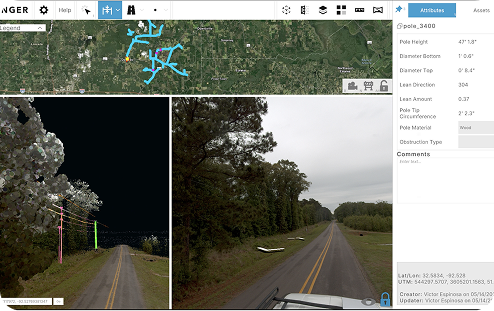
Transform how you deliver source data and GIS layers to clients with stunning web-based visualization that handles tens of thousands of miles of LiDAR and imagery—all accessible through any browser.
Powerful client presentations meet seamless data integrations
Deliver impressive client experiences with interactive visualization of massive datasets, bringing complex information to life in an intuitive and engaging environment.
Seamlessly explore and present detailed data with powerful visualization tools, complete with support for client GIS data integration through simple shapefile uploads.
Navigate complex datasets with ease and provide clients with a clear, interactive, and immersive way to understand their data.
TWO POWERFUL TOOLS
Cloud LiDAR Extraction & Visualization Built for Enterprise Teams
Validate Your Collection
Review your point cloud and imagery in a GIS-referenced environment to confirm coverage completeness and build familiarity with the project area before extraction begins.
Verify Your Extraction
Examine extracted features within the point cloud and against panoramic imagery to verify accuracy and catch errors before final delivery.
Analyze In Depth
Draw conclusions from your data using built-in measurement tools and detailed attribute tables — going beyond what a static deliverable can show.
Deliver to Clients
Publish your collected and extracted data as an interactive map, giving clients direct access to their project data and maximizing the value of every deliverable.
KEY CAPABILITIES
Massive Dataset Visualization
HANDLE SCALE WITHOUT COMPROMISE
3D Analysis
Leverage LiDAR point cloud with bespoke measurement tools
Tens of Thousands of Miles
Explore vast geographic areas with high-performance data rendering.
Multi-View Display
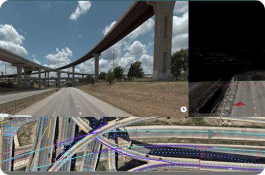
Visualize point cloud and imagery side by side for additional context
Interactive Navigation
Enjoy smooth, responsive navigation across datasets.
CLIENT DATA
Elevate your client data deliveries
Collected Data Exploration
drive through imagery and point cloud without leaving the office
Extracted Asset Analysis
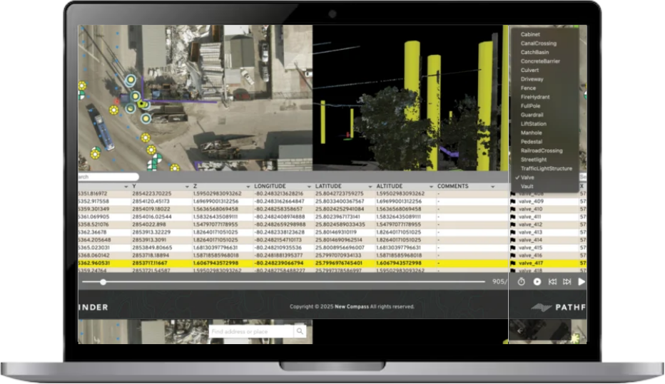
Click on asset icons in LiDAR or base map to examine attributes
Attribute Table Viewing
Search, filter, and navigate assets through the attribute table pane
Local Data Downloads
further explore data with local downloads of collected data
CLIENT DATA
Elevate your client data deliveries
Bring your Client’s data into the conversation
3D Analysis
Leverage LiDAR point cloud with bespoke measurement tools
Tens of Thousands of Miles
Explore vast geographic areas with high-performance data rendering.
Multi-Format Support
Seamlessly display various mapping data types in unified interface
Multi-View Display
Visualize point cloud and imagery side by side for additional context
Interactive Navigation
Enjoy smooth, responsive navigation across datasets.
CLIENT DATA
Experience Benefits
ELEVATE YOUR CLIENT RELATIONSHIPS
Professional Presentations
Impress clients with interactive, high-resolution data visualization
Collaborative Review
Save and share notes, locations, measurements, and views amongst your team
Data Transparency
Let clients see exactly what was captured and extracted
Integration Flexibility
Accommodate client workflows by importing their existing GIS data
Ready to transform your client deliveries?
See how Asula Visualize can transform your overall project efficiency, streamline your workflows, and improve client satisfaction.
Asula Geospatial Solutions is proud to partner with Carahsoft, The Trusted IT Solutions Provider®, to deliver innovative software solutions that empower mission success.