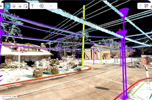
Powered by the Unity gaming engine and AWS backend, Asula Extract delivers powerful, cloud-based technology for LiDAR extraction.
Using the same real-time 3D rendering engine behind some of the world’s most demanding visualizations, it brings high-performance technology into an intuitive environment.
Navigate point cloud environments with fluid, intuitive controls and experience seamless visualization, streamed entirely from the cloud.
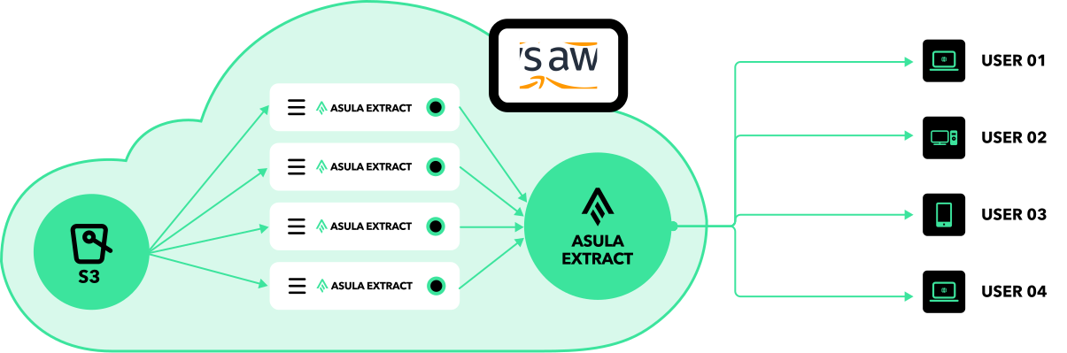
Asula Extract’s cloud-native design delivers enterprise-grade extraction through any web browser. No expensive hardware upgrades, no downloading massive datasets to individual workstations, no software updates across multiple machines. Your team accesses everything they need instantly, while all processing happens in our optimized cloud infrastructure.
Project managers create custom data dictionaries tailored for any client or project. Extractors assigned to that project only see tools and interfaces that align with the specific assets and attributes defined in the project data dictionary—ensuring consistency and eliminating confusion.
Organize and oversee extraction workflows from start to finish
Seamlessly import LiDAR and imagery datasets
Tailor point, polyline, and polygon asset and attribute definitions for any client or project type
Run AI-powered point cloud classification of over 40 categories
Assign extractors to specific project assets and hubs
Automated, semi-automated, and manual extraction capabilities matched to your project requirements.
Deliver results in GIS formats
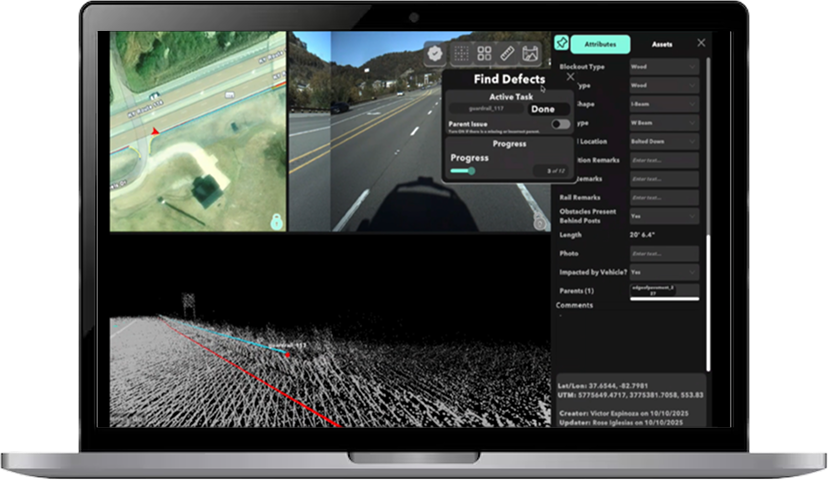
Sampling algorithms identify defect opportunities for QA/QC validation.
Comprehensive analytics on project quality performance
Verify that extraction meets specified accuracy requirements
Automatically identifies and extracts certain assets (point and polyline) from your datasets.
All classification and automated extraction take place in the Asula Extract platform so there is no need to use additional software to view or quality control outputs.
Process large areas of data in a fraction of the time, getting your results sooner.
Improves data consistency and reduces human error for high-quality, dependable results.
Precisely map identified assets & attributes within point cloud data
Project managers can run AI/ML analysis before assigning human extractors, streamlining the entire workflow
Automatically identify assets within panoramic imagery and point cloud data.
Import existing .shp files to spatially join to new assets created in AEX.


Asula Geospatial Solutions is proud to partner with Carahsoft, The Trusted IT Solutions Provider®, to deliver innovative software solutions that empower mission success.
Trusted Partner
Dedicated Support
Serving the Public Sector